


Algorithms and Geospatial Data Tools
A guide to geodesic algorithms and geospatial data tools for distance calculation and visualization using Python or JavaScript


Table of contents
Abstract:
Geographic Information Systems, or GIS, are critical for various applications such as location-based services, environmental monitoring, urban planning, and agriculture. This blog post provides an overview of popular geospatial data libraries and tools in Python and JavaScript, and discusses four geodesic algorithms: Haversine, Spherical Law of Cosines, Vincenty, and Great-circle distance. The post aims to help readers choose the best algorithm for their geospatial data visualization needs and provides resources for those interested in learning more. The blog also covers the Earth's shape and its impact on geospatial calculations, and presents real-world examples of geospatial data and algorithm applications.
Introduction
Geospatial data visualization involves calculating distances between two points on the Earth's surface using geodesic algorithms. There are many such algorithms available, each with its own strengths and weaknesses. In this blog post, we will explore four popular algorithms - Haversine, Spherical Law of Cosines, Vincenty, and Great-circle distance - and discuss their pros and cons.
Python and JavaScript are popular languages for working with geospatial data because of their ease of use and availability of powerful libraries. We will provide an overview of popular geospatial data libraries and tools in these languages, including GeoPandas, folium, and geopy. Additionally, we will provide specific examples of real-world applications of geospatial data and algorithms to help readers understand their practical use.
It's important to note that geospatial calculations are affected by the Earth's shape. While it's often assumed to be a perfect sphere in some algorithms, it is in fact an oblate spheroid. This can lead to differences in accuracy when calculating distances between points. We will provide an overview of the Earth's shape and its effect on geospatial calculations in this blog post as well.
What is geospatial data?
Geospatial data refers to data that has a geographic component, such as location information.
Why is Python a popular choice for geospatial data analysis and visualization?
Python is a popular language for working with geospatial data because of its ease of use and availability of powerful libraries. Here are a few examples:
Geopandas
GeoPandas is a library that extends the popular data manipulation library, pandas, by adding support for geospatial data. It can read a variety of spatial file formats, including shapefiles, and perform spatial operations on the data.
Here is the code for the Geospatial Population Visualizer built with Python, GeoPandas, Contextily, and Matplotlib, showcasing the power of geospatial data manipulation and visualization for insightful analysis:
# filename: geospatial_data.py

import geopandas as gpd
import matplotlib.pyplot as plt
import contextily as ctx
import random
from shapely.geometry import Point

def generate_random_points_within_polygon(polygon, num_points):
    points = []
    min_x, min_y, max_x, max_y = polygon.bounds

    while len(points) < num_points:
        random_point = Point([random.uniform(min_x, max_x), random.uniform(min_y, max_y)])
        if random_point.within(polygon):
            points.append(random_point)

    return points

# load world shapefile
world = gpd.read_file(gpd.datasets.get_path('naturalearth_lowres'))
world = world[world.name != 'Antarctica']
world.crs = 'EPSG:4326'

# generate random points within the world shapefile
num_points = 1000
random_points = generate_random_points_within_polygon(world.unary_union, num_points)

# create a GeoDataFrame with the random points
gdf = gpd.GeoDataFrame(geometry=random_points, crs='EPSG:4326')

# add a 'POPULATION' column with random population values
gdf['POPULATION'] = [random.randint(50000, 500000) for _ in range(len(gdf))]

# filter data
gdf = gdf[gdf['POPULATION'] > 100000]

# reproject to Web Mercator
gdf = gdf.to_crs(epsg=3857)
world = world.to_crs(epsg=3857)

# create a plot
ax = gdf.plot(column='POPULATION', cmap='viridis', legend=True, figsize=(15, 8), markersize=30)

# add a basemap
ctx.add_basemap(ax, zoom=1, source=ctx.providers.Stamen.Terrain)

# set the x and y limits of the plot to match the world shapefile extent
xlim = world.total_bounds[[0, 2]]
ylim = world.total_bounds[[1, 3]]
ax.set_xlim(xlim)
ax.set_ylim(ylim)

# set the aspect of the plot equal to the aspect of the world shapefile in Web Mercator projection
ax.set_aspect('equal')

# set axis labels and title
ax.set_xlabel('Longitude')
ax.set_ylabel('Latitude')
ax.set_title('Random Points with Population > 100,000')

# save the plot to the output folder
output_file = 'output/geospatial_plot.png'
plt.savefig(output_file, dpi=300, bbox_inches='tight')

# show the plot
plt.show()
The `.py` script above performs the following operations:
Import required libraries (
geopandas,matplotlib,contextually,random)Read the
shapefileusinggeopandasAdd a
POPULATIONcolumn with random population valuesFilter the
GeoDataFrameto include only points with population greater than 100,000Set the CRS of the GeoDataFrame to WGS84 (EPSG:4326)
Reproject the GeoDataFrame to Web Mercator (EPSG:3857)
Remove points that are not within the bounds of the world map
Create a plot using
geopandas andmatplotlib`, with the population as the color scaleAdd a
basemapusingcontextilySet axis labels and title for the plot
Save the plot as an image in the output folder
Display the plot
Thus, the script creates a geospatial plot with random points and population data, save it as geospatial_plot.png in the output folder, and display the plot in a window:

Folium
Using folium to create interactive maps:
import folium

# create map object centered at Portland, OR
m = folium.Map(location=[45.5236, -122.6750], zoom_start=13)

# add markers for Portland and Oregon Convention Center
folium.Marker([45.5236, -122.6750], popup='Portland, OR').add_to(m)
folium.Marker([45.5244, -122.6699], popup='Oregon Convention Center').add_to(m)

# display map
m
Folium is a library for creating interactive maps that can be displayed in a web browser. It uses the Leaflet JavaScript library under the hood and provides a Pythonic interface for creating and customizing maps. In this example, we create a map centered on Portland, OR and add two markers to it.
Geopy
Using geopy to calculate geodesic distance:
from geopy import distance

# define two points
point1 = (52.2296756, 21.0122287)
point2 = (52.406374, 16.9251681)

# calculate geodesic distance
dist = distance.geodesic(point1, point2).km

print(dist)
Geopy is a library for working with geospatial data that provides support for geocoding, reverse geocoding, and calculating distances between points. In this example, we define two points using latitude and longitude coordinates and use the geodesic() method to calculate the distance between them.
These are just a few examples, but there are many more Python libraries and tools available for working with geospatial data. Some popular ones include Shapely for performing geometric operations on shapes, Basemap for creating static maps, and Cartopy for creating maps using matplotlib.
With the abundance of resources available, Python is an excellent language for exploring and analyzing geospatial data.
Popular Geospatial Data Libraries and Tools
Nevertheless, there is a pleura of resources available for working with geospatial data:
The table presents a collection of geospatial tools and libraries, organized by categories. It includes brief descriptions, resource links, and covers various languages or platforms.
Geodesic Algorithms for Distance Calculation
Why is the shape of the Earth important in geospatial data analysis, and how is it accounted for?
As for the Earth's shape, it is an oblate spheroid, meaning it is not perfectly round, but rather slightly flattened at the poles and bulging at the equator. This shape affects geospatial calculations because the distance between two points on the Earth's surface is not always a straight line, but rather follows the curve of the Earth's surface. As a result, geodesic algorithms that take into account the Earth's shape are needed to calculate distances accurately.
Haversine Formula
The Haversine formula is a simple method that assumes the Earth is a perfect sphere. It is easy to implement and fast to compute, making it a popular choice for many geospatial visualization tasks. However, its assumption of a perfect sphere may result in less accurate calculations compared to other methods.
To understand the Haversine formula, imagine two stickers on a ball. The distance between them can be calculated by pretending the ball is perfectly round.
d = 2r * asin(sqrt(sin^2((lat2-lat1)/2) + cos(lat1) * cos(lat2) * sin^2((lon2-lon1)/2))))
Spherical Law of Cosines
The Spherical Law of Cosines is similar to the Haversine formula but uses a different type of math to calculate the distance. It also assumes the Earth is a perfect sphere and may have similar limitations in accuracy.
To understand the Spherical Law of Cosines, imagine two stickers on a ball. The distance between them can be calculated using a special rule to calculate the length of the straight line between the stickers.
r * acos(sin(lat1) * sin(lat2) + cos(lat1) * cos(lat2) * cos(lon2 - lon1))
Vincenty Formula
The Vincenty formula takes into account the flattening of the Earth's shape, using iterative calculations to account for the differences in shape at the poles and equator. This makes it more accurate than the Haversine and Spherical Law of Cosines formulas.
To understand the Vincenty formula, imagine two stickers on an egg. The distance between them can be calculated by taking into account the egg's non-spherical shape.
Great-circle Distance Formula
The great-circle distance formula calculates the shortest distance between two points on the surface of the Earth by following the curve of the Earth's surface. It is the most accurate method for calculating distances on a sphere but is also the most complex and slowest to compute.
To understand the Great-circle distance formula, imagine two stickers on a ball. The shortest distance between them can be calculated by drawing a line that follows the curve of the ball, like the equator.
d = r * acos(sin(lat1) * sin(lat2) + cos(lat1) * cos(lat2) * cos(lon2 - lon1))
The table below provides a summary of the four geodesic algorithms:
Pros and Cons of Geodesic Algorithms
Here is a table summarizing the pros and cons of each algorithm in terms of accuracy, computational complexity, and implementation details:
Real-world Application
Here are a few examples of real-world applications of geospatial data and algorithms:
Location-Based Services: Many apps and services use geospatial data to provide location-based services to their users. For example, ride-hailing apps like Uber and Lyft use GPS data to match drivers with riders and provide real-time information about their location.
Environmental Monitoring: Geospatial data and algorithms are also used for environmental monitoring. For instance, satellite imagery can be used to monitor changes in land use and detect deforestation. This information can help researchers and policymakers make informed decisions about conservation efforts.
Urban Planning: Geospatial data and algorithms are critical for urban planning. For instance, planners can use geospatial data to analyze traffic patterns and optimize traffic flow. They can also use data to identify areas that are most in need of infrastructure improvements or public services.
Agriculture: Geospatial data and algorithms can be used to optimize crop yields and reduce waste. For instance, farmers can use satellite imagery and geospatial data to monitor crop health and identify areas that require irrigation or fertilization. This can help increase crop yields and reduce waste.
Conclusion
Geodesic algorithms and geospatial data tools are crucial for precise distance calculation and geospatial data visualization. Selecting the optimal algorithm for a specific use case necessitates a thorough evaluation of factors such as accuracy, computational complexity, and implementation nuances. Remain open to various methods and conduct comparative tests to pinpoint the most suitable algorithm for your project.
In conclusion, we trust this blog post has clarified these concepts and aided in selecting the ideal algorithm for your geospatial data visualization endeavors. If you found this blog informative and valuable, please consider liking or sharing it with others who might benefit. For questions or feedback, feel free to leave a comment below. We appreciate your engagement and support.
Acknowledgments
We would like to express our gratitude to the developers and maintainers of the various geospatial data libraries and tools discussed in this blog post. Their hard work and dedication have significantly contributed to the growth and advancement of the geospatial data visualization and analysis community.
Special thanks to the following projects and organizations for their invaluable resources and support:
GeoPandas (geospatial data analysis)
QGIS (geographic information system)
Leaflet (web mapping)
OpenLayers (web mapping)
D3.js (data visualization)
Turf.js (geospatial analysis)
GeographicLib (geodesy)
NASA Earth Observatory (satellite imagery)
United States Department of Agriculture (USDA) (soil data)
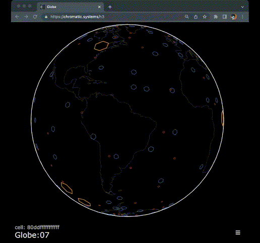
This blog post was inspired by the H3 library of chromatic.systems. We thank the team for their contributions to the geospatial data visualization community. Your efforts have made it possible for professionals and enthusiasts alike to effectively analyze, visualize, and understand the complexities of geospatial data.
Your feedback and support inspire us to continue exploring and sharing the marvels of geospatial data analysis and visualization. If you found this blog post informative and valuable, please consider liking or sharing it with others who might benefit.
Keywords: geospatial data, geodesic algorithms, distance calculation, Python, JavaScript, Earth's shape, computational complexity, GeoPandas, folium, geopy, Leaflet, OpenLayers, D3.js, QGIS, Turf.js, GeographicLib, data visualization, Haversine, Spherical Law of Cosines, Vincenty, Great-circle distance, location-based services, environmental monitoring, urban planning, agriculture, satellite imagery, geocoding, reverse geocoding, Shapely, Basemap.